Monday 13th March 2023: Over the last few weeks, Paul G9PUV in the SE of England and Robbie, EI2IP in the SW of Ireland have been very active on the 40 MHz (8m) band. On the evening of the 13th of March, there was a remarkable opening when their FT8 signals were heard in New Zealand.
The map above shows the direct paths in Purple. The path from EI2IP goes over the Arctic to the west while the path from G9PUV goes east and over the far north of Russia, both highly unlikely paths at a frequency of 40 MHz.
The strange thing is that 40 MHz didn't seem to take the short path or the long path but a skewed path. A suggested path is shown above in Orange but in reality, we'll never know for sure the exact path.
Here are the reception reports from ZL1RS in New Zealand...
Txmtr Band Mode Distance Time (UTC) SNR
WM2XEJ 8m FT8 13129 km 19:47:26 7
EI2IP 8m FT8 18096 km 19:35:14 -21
G9PUV 8m FT8 18206 km 18:54:14 -17
Note that ZL1RS was hearing the the experimental US station WM2XEJ as well at about the same time.
G9PUV: The map above shows the FT8 paths for Paul, G9PUV in the evening time. Note that there was a path also open to the Caribbean about 20 mins after the opening to New Zealand.
These are the FT8 reports...
Txmtr Rcvr Band Mode Distance Time (UTC) SNR
G9PUV EA8/DF4UE 8m FT8 2730 km 19:18:00 -13
G9PUV EA1TX 8m FT8 1086 km 19:15:41 -15
G9PUV FG8OJ 8m FT8 6618 km 19:14:14 -11
G9PUV HC02 8m FT8 1657 km 19:14:14 -17
G9PUV HI0SDR/3 8m FT8 6983 km 19:14:00 -17
EA1TX G9PUV 8m FT8 1086 km 19:13:59 -14
G9PUV K6EU 8m FT8 8704 km 19:00:14 -21
G9PUV ZL1RS 8m FT8 18206 km 18:54:14 -17
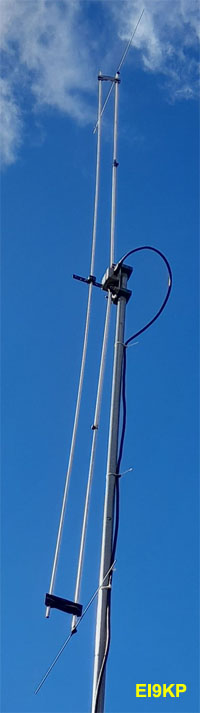
G9PUV was using a log-periodic antenna at rooftop level and was beaming 195 degrees. The actual beam heading for New Zealand may have been some bit off this.
EI2IP: The map above shows the paths for EI2IP during the evening. Again, note that there was an opening to the Caribbean and the south-east of the USA.
Rcvr Band Mode Distance Time (UTC) SNR
FG8OJ 8m FT8 6092 km 19:52:44 -12
WW1L 8m FT8 4389 km 19:52:14 -2
K6EU 8m FT8 8152 km 19:52:12 -11
WM2XCC/JTDX 8m FT8 8244 km 19:49:58 -19
K1HTV-4 8m FT8 5390 km 19:40:45 -17
WM2XCC 8m FT8 8244 km 19:40:44 -20
PJ4MM 8m FT8 6895 km 19:39:11 -15
EA8/DF4UE 8m FT8 2676 km 19:37:00 -10
EA1TX 8m FT8 1223 km 19:36:11 -11
ZL1RS 8m FT8 18096 km 19:35:14 -21
HC02 8m FT8 1705 km 19:32:15 -11
N4WLO/3 8m FT8 6684 km 19:32:14 -17
HI0SDR/3 8m FT8 6405 km 19:32:00 -12
K5YT 8m FT8 6935 km 19:19:41 -24
HI0SDR 8m FT8 6461 km 19:06:30 -19
WM2XEJ 8m FT8 6135 km 19:06:14 -22
WP4G 8m FT8 6209 km 19:05:42 -17
N2OTO 8m FT8 6487 km 19:05:30 -8
EI2IP reports using a 4-element Yagi and was beaming at 200 degrees which is roughly pointing at South America.
WM2XEJ: It's interesting to look at the evening reports and paths for the US experimental station WM2XEJ in Georgia. You'll note that there was a path open both to ZL1RS at 19:47 UTC and to EI2IP at 19:35 UTC.
As you can see from the map above, it's not hard to imagine a situation where the path becomes skewed and then the EI to ZL path becomes possible. In that case, it's likely that the path was in the region of about 19,000kms.
Short Path or Long Path??? ... Strictly speaking, it was probably a skewed short path for EI2IP and a skewed long path for G9PUV. The more correct question is probably if the path was skewed or not? The more informative answer is that the path was skewed and learn from that.
Lessons: It's worth remembering that the TEP zone around the Geomagnetic Equator is likely to have a huge impact on any 40 MHz signals crossing it. I would take these points from this...
1) The date... We're in the middle of March and near the equinox.
2) The time... Roughly 18:45 to 20:00 UTC
3) Location... This applies to stations in the north of New Zealand and the NW of Europe.
4) Beam heading... Stations in New Zealand should beam at the Caribbean and stations in the UK and Ireland should beam at the South America or the Caribbean.
5) Skewed Paths.... Forget long path and short paths and direct lines on the map which can go all over the place when the other station is at the other side of the planet. 40 MHz signals are going to have a really tough time crossing over the north or south poles... look for skewed paths where the signal stays as close to the equator as possible.
6) 50 MHz... Any serious 50 MHz operators should be reading this and then trying to explore this path. If it can be done at 40 MHz then maybe 50 MHz is possible?
In conclusion: The Trans-Equatorial Propagation zone around the geomagnetic equator has a huge impact on low band VHF signals on the 40 MHz and 50 MHz bands. In the past, we only really had SSB and CW available in terms of popular modes. Now with so many stations on the one frequency using a weak signal mode like FT8, we can see signals that are buried in the noise.
There are probably plenty of other skewed paths that are possible. The key is to get out of the fixed mindset of short path and long path and think about beaming at this TEP zone at an angle and see if a signal can propagate inside it or be bent by it.
It's likely the windows of opportunity will be short... the TEP zone ionization needs to be right and there may be sunrise or sunset peaks along the path.
It's likely that there are probably plenty more new skewed paths out there awaiting discovery.
Link... For more information on the 8m band, see my 40 MHz page.